Dengler Images

  • Portfolio
    • Portfolio Book
    • Sample Images
  • Archive
  • Blog
  • Store
    • Licensing
    • Prints
    • Note cards
    • Books
  • About
    • Bio
    • Services
    • Newsletter Signup
    • Instagram
    • Copyright
    • Privacy Policy
  • Contact

After a million visiting birds, quiet time at Loess Bluffs

February 4, 2022 by John L. Dengler

A juvenile bald eagle feeds on the remains of waterfowl in the Pelican Pool at the Loess Bluffs NWR (formerly known as Squaw Creek). Loess Bluffs is a wildlife refuge managed by the U.S. Fish and Wildlife Service. The 700-acre refuge, located in northwest Missouri is known for the migrating waterfowl, particularly Snow Geese. Fall and Spring migration can bring millions of Snow Geese to the refuge. Also, bald eagles and an occasional golden eagle pass through the area during the fall and winter months. The 10-mile auto tour around the waterways and marshes of the refuge is an excellent way to spot birds of prey, waterfowl, beavers, otters, and muskrats.
A juvenile bald eagle feeds on the remains of waterfowl in the Pelican Pool at Loess Bluffs NWR.

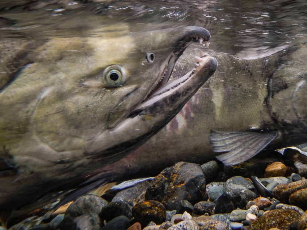
A few weeks ago, I made a scouting trip to the Loess Bluffs National Wildlife Refuge in northwest Missouri near the Nebraska/Iowa/Missouri border. I use the word “scouting” trip as I knew I was traveling there long after the big migration of waterfowl (and the accompanying bald eagles) had passed through. Still, I wanted to make the trip because I have wanted to check the area out for over a decade so I knew what to expect when I would return during the height of the massive migration of millions, yes millions of birds.

Sunset over the Cattail Pool at Loess Bluffs NWR (formerly known as Squaw Creek). Loess Bluffs is a wildlife refuge managed by the U.S. Fish and Wildlife Service. The 700-acre refuge, located in northwest Missouri is known for the migrating waterfowl, particularly Snow Geese. Fall and Spring migration can bring millions of Snow Geese to the refuge. Also, bald eagles and an occasional golden eagle pass through the area during the fall and winter months. The 10-mile auto tour around the waterways and marshes of the refuge is an excellent way to spot birds of prey, waterfowl, beavers, otters, and muskrats.
Sunset over the Cattail Pool at Loess Bluffs NWR.
Snow and ice on the Snow Goose Pool Complex at Loess Bluffs NWR (formerly known as Squaw Creek). Loess Bluffs is a wildlife refuge managed by the U.S. Fish and Wildlife Service. The 700-acre refuge, located in northwest Missouri is known for the migrating waterfowl, particularly Snow Geese. Fall and Spring migration can bring millions of Snow Geese to the refuge. Also, bald eagles and an occasional golden eagle pass through the area during the fall and winter months. The 10-mile auto tour around the waterways and marshes of the refuge is an excellent way to spot birds of prey, waterfowl, beavers, otters, and muskrats.
Snow and ice on the Snow Goose Pool Complex.
Sunset over the Cattail Pool at Loess Bluffs NWR (formerly known as Squaw Creek). Loess Bluffs is a wildlife refuge managed by the U.S. Fish and Wildlife Service. The 700-acre refuge, located in northwest Missouri is known for the migrating waterfowl, particularly Snow Geese. Fall and Spring migration can bring millions of Snow Geese to the refuge. Also, bald eagles and an occasional golden eagle pass through the area during the fall and winter months. 

The 10-mile auto tour around the waterways and marshes of the refuge is an excellent way to spot birds of prey, waterfowl, beavers, otters, and muskrats.
Sunset over the Cattail Pool at Loess Bluffs NWR (formerly known as Squaw Creek).

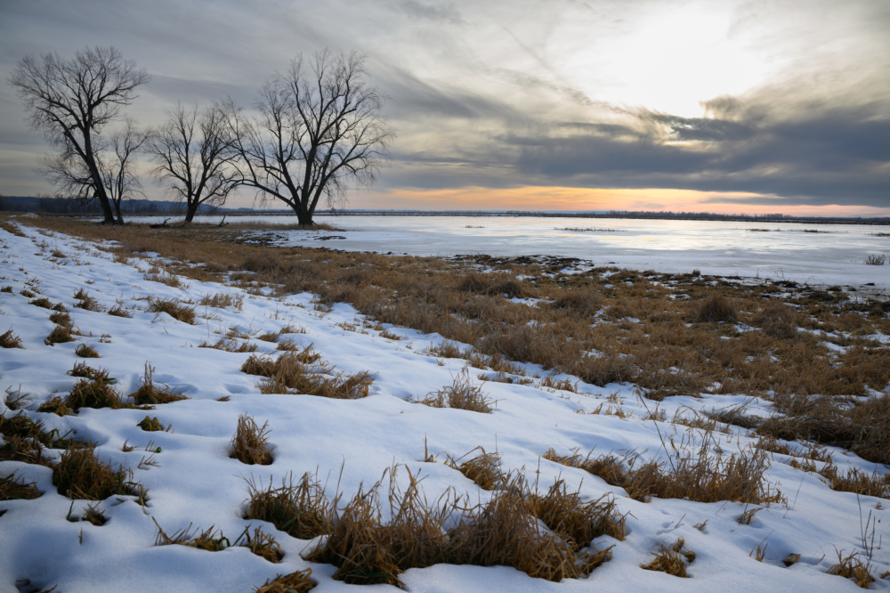
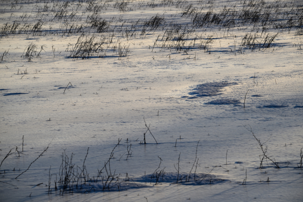
I found the refuge (formally known as Squaw Creek) largely deserted, not only of people but of waterfowl. Outside of a few waterfowl stragglers, a few bald eagles (likely resident), and a coyote or two. Of the 7,440 acres of the frozen landscape, I found only one small pool of water that wasn’t frozen over. It was quite a distance, and any attempt of trying to get closer to the waterfowl would have caused them to take flight and expend their much-needed energy. As the saying goes, if all you have are lemons, you make lemonade, which is what I did. The results are nothing to shout about, but it allowed me to get a feel for the possibilities for future trips to the refuge.

I look forward to returning.

A juvenile bald eagle swoops down on trumpeter swans and other waterfowl in the Snow Goose Pond Complex at Loess Bluffs NWR (formerly known as Squaw Creek). Loess Bluffs  is a wildlife refuge managed by the U.S. Fish and Wildlife Service. The 700-acre refuge, located in northwest Missouri is known for the migrating waterfowl, particularly Snow Geese. Fall and Spring migration can bring millions of Snow Geese to the refuge. Also, bald eagles and an occasional golden eagle pass through the area during the fall and winter months. 

The 10-mile auto tour around the waterways and marshes of the refuge is an excellent way to spot birds of prey, waterfowl, beavers, otters, and muskrats.
A juvenile bald eagle swoops down on trumpeter swans and other waterfowl in the Snow Goose Pond Complex.
An injured coyote makes his way across the frozen and snow covered pond of the Snow Goose Complex at Loess Bluffs NWR (formerly known as Squaw Creek). Loess Bluffs is a wildlife refuge managed by the U.S. Fish and Wildlife Service. The 700-acre refuge, located in northwest Missouri is known for the migrating waterfowl, particularly Snow Geese. Fall and Spring migration can bring millions of Snow Geese to the refuge. Also, bald eagles and an occasional golden eagle pass through the area during the fall and winter months. 

The 10-mile auto tour around the waterways and marshes of the refuge is an excellent way to spot birds of prey, waterfowl, beavers, otters, and muskrats.
An injured coyote makes his way across the frozen and snow covered pond of the Snow Goose Complex.
A bald eagle awaits sunrise as the moon sets at Loess Bluffs NWR (formerly known as Squaw Creek). Loess Bluffs is a wildlife refuge managed by the U.S. Fish and Wildlife Service. The 700-acre refuge, located in northwest Missouri is known for the migrating waterfowl, particularly Snow Geese. Fall and Spring migration can bring millions of Snow Geese to the refuge. Also, bald eagles and an occasional golden eagle pass through the area during the fall and winter months. The 10-mile auto tour around the waterways and marshes of the refuge is an excellent way to spot birds of prey, waterfowl, beavers, otters, and muskrats.
A bald eagle awaits sunrise as the moon sets.

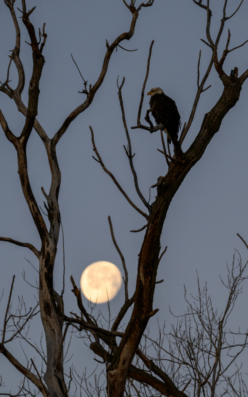
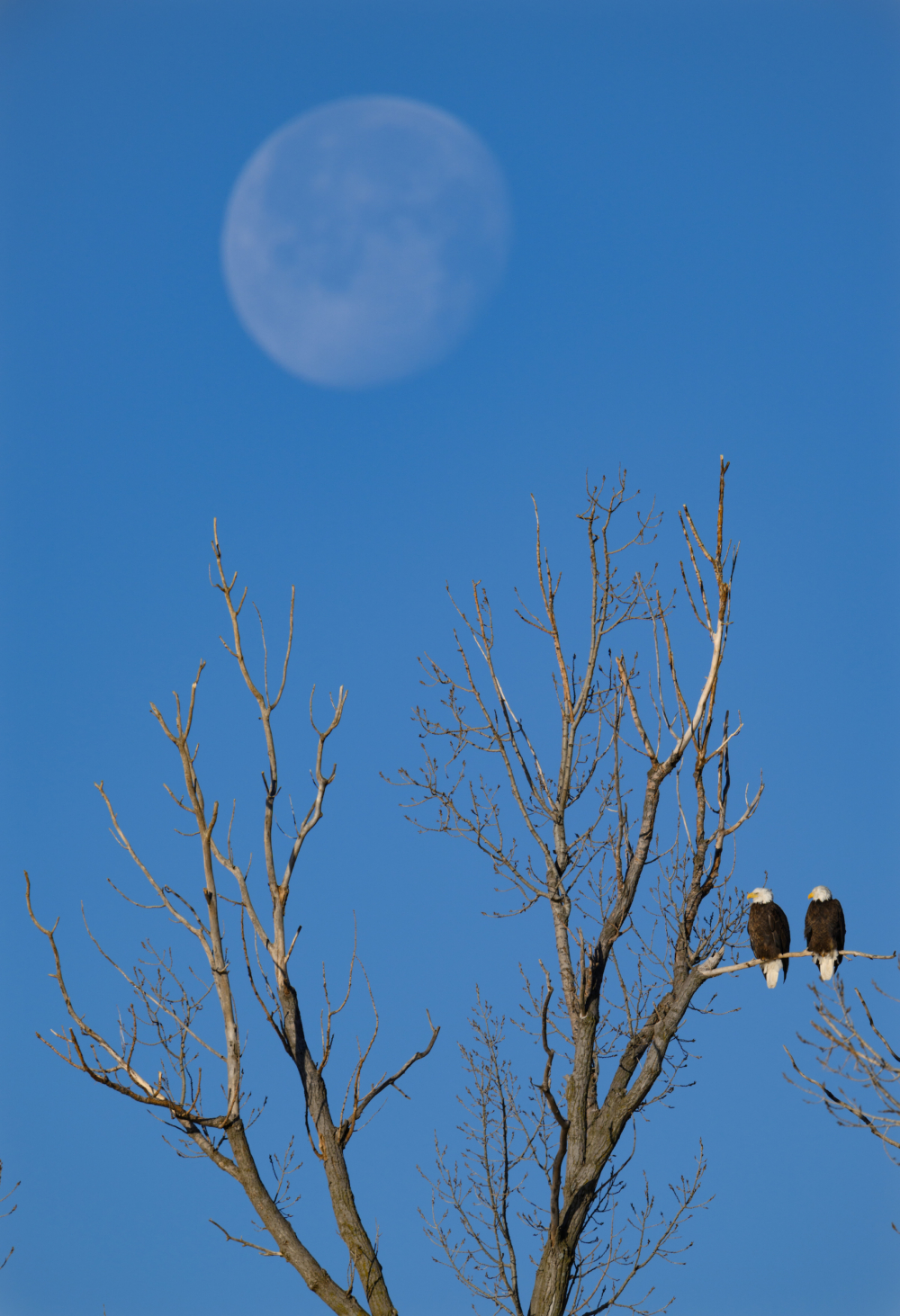
Fall and Spring migration can bring millions of snow geese to the refuge. Also, bald eagles and an occasional golden eagle pass through the area during the fall and winter months. The 10-mile auto tour around the waterways and marshes is a great way to spot birds of prey, waterfowl, beavers, otters, and muskrats.

VIEWER’S TIP: Eagles are less likely to fly away if you view from inside your car. Your car is a great “mobile” blind.
A pair of bald eagles perched in a tree overlooking the Cattail Pool at Loess Bluffs NWR (formerly known as Squaw Creek). Loess Bluffs is a wildlife refuge managed by the U.S. Fish and Wildlife Service. The 700-acre refuge, located in northwest Missouri is known for the migrating waterfowl, particularly Snow Geese. Fall and Spring migration can bring millions of Snow Geese to the refuge. Also, bald eagles and an occasional golden eagle pass through the area during the fall and winter months. The 10-mile auto tour around the waterways and marshes of the refuge is an excellent way to spot birds of prey, waterfowl, beavers, otters, and muskrats.
A pair of bald eagles perched in a tree overlooking the Cattail Pool at Loess Bluffs NWR as the moon sets on a chilly January morning.

VIEW PHOTO GALLERY of all my Loess Bluffs National Wildlife Refuge photos

Be the first to know ‘Follow’ Dengler Images on Instagram @DenglerImages or follow my Twitter feed to know when I post iPhone reports from the field.

THANK YOU
to those who made my career so fulfilling

October 27, 2021 by John L. Dengler

John L. Dengler was recently inducted into the Missouri Photojournalism Hall of Fame. Here are his remarks (and slides shown) in which he thanked those who played an important role in his career as a photojournalist, graphics editor, design editor, and creative director. The ceremony took place at the State Historical Society of Missouri Center for Missouri Studies located in Columbia, Mo. on October 21, 2021. Rita Reed, former Minneapolis Star-Tribune photojournalist and professor emeritus at the Missouri School of Journalism introduced Dengler.


Thank you, Rita. Your introduction truly humbles me. Only my grandmother could top you in promoting my accomplishments. 

I always felt sorry for the waitresses at the rural diner where I took my grandmother for lunch. She’d keep the waitress’s hand pressed to the tabletop to keep her at the table until my grandmother finished her exaggerated spiel of what I did at the newspaper. It would always end up with a wink from the waitress to me, indicating that waitress knew that I wasn’t, as what my grandmother was describing, the publisher of the newspaper.


I want to begin by first thanking the subjects I have met during my career, as they are the ones who truly have made my standing here today possible. I’ve always been amazed how people allow photographers to share their lives and stories with others through our lenses.

© 1976 St. Louis Globe-Democrat, Photo by John L. Dengler

Here is Tony Gagliarducci, the last of the traveling tool grinders in St. Louis, as he pushes his 300-pound pushcart at age 77. He claimed to walk up to 20 miles a day, six days a week. 

© 1985 St. Louis Globe-Democrat, Photo by John L. Dengler

Sometimes subjects had no choice to enter my lens like this woman being comforted by a police officer after learning that her husband, a demolition worker, was crushed to death in a building collapse. Ironically, the day before, the construction worker had told friends that he feared for his safety on the job. 

I hope the folks I have encountered found that I captured their good and bad times with respect, compassion and truth.


I can’t imagine a more enriching career or life experience than what I have had — and then to be able to share those experiences with others is an honor. Those experiences have taken me to a hidden cave in Missouri so newly discovered that fewer than a half dozen people have been in, to high in a Costa Rican rainforest canopy to document the work of researchers from the Missouri Botanical Garden.

I also want to thank those who helped shape my early professional career, starting with my high school journalism teachers Larry Gross and Mike Killenberg. Killenberg took a chance on me as an incoming freshman and gave me special permission to join the newspaper staff, something previously only reserved for seniors.

In journalism school, Angus McDougall provided the inspiration to tell impactful visual stories through thoughtful photography, photo editing, and design. I could go on for an hour talking about his professional impact and even more hours talking about the friendship that included his wife Betty years after I left school.

Betty and Angus McDougall at a NPPA connvention in Vail, Colorado in 1977. (photographer unkown)
The St. Louis Globe-Democrat photo staff – (Back, L-R) Bill Stover, Jack Fahland, John L. Dengler, Rick Stankoven, Ed Sedej, Bob Diaz, Dick Weddle, John Bloomquist, T.V. Vessell, Bill Brinson. (Front) Paul Ockrassa, Ken Winn. Not pictured Bob Moore, Cliff Willis, Jim Rentz, Howard Vogt

I also want to thank my fellow photographers at the Globe-Democrat and even our competition, the Post-Dispatch photographers, for either knowingly pushing me to strive to be better with advice or unknowingly through friendly competition. Working in a two-newspaper town was a blast.

While I had already worked at the Globe for three years part-time while in college (thank you, Greyhound Bus Lines), after graduation I became the features page designer due to a lack of openings in the photo department. While I saw this as a setback in my photography career, it was critical to my future direction. During the one year in this position, I polished my design and typography skills while at the same time receiving deep institutional knowledge of the production of the newspaper. 

Photo credit: Rick Stankoven / St. Louis Globe-Democrat

Technically, once I went back to being a staff photographer, I was no longer supposed to do page design since the paper’s employees were members of the Newspaper Guild. Union rules meant everyone had to keep within their very specific job description.

But that didn’t stop me from designing my own photo stories. Amazingly, everyone knew what I was doing with the picture stories I was producing, but everyone looked the other way. To those folks, I owe a REALLY BIG thanks. These photo pages were simple slice of life stories frequently focused on rural life or environmental topics. Looking back, I’m actually surprised by the number of stories produced.

Globe-Democrat writer Bill Anderson and I often teamed up for these stories. We made a great team and respected each other’s role in the storytelling process. Thank you, Bill, we sure had some great times exploring the back roads.


Thank you to the front page editors, who indulged me when I turned in non-standard format photos like this photo of the aftermath of a snowstorm. Narrow-cropped photos like this one on deadline would mean that the front page editor would have to totally redo the front page design. However, because I would often print the image to an actual column size it would usually be an easy sell when I dropped the photo on their life-size dummy sheet.


Jeff Harper, Bridget McCarthy, John L. Dengler, Ed Peaco and Chris Mostyn are just a handful of the artists, designers, and infographic reporters who have worked in the News-Leader Graphics Department.

To the team of graphic artists at the Springfield News-Leader, thank you for making me look better than I am. 

(Caption by Chuck Todd) “The Pica Pole Gang” – The Springfield News-Leader graphics crew, circa 1996. Seated is the Godfather of the gang, John Dengler, graphics director and now a member of Missouri Photojournalism Hall of Fame. He holds the deadly weapon used to cudgel artists into hitting deadlines and winning awards for their infographics, design, and illustration work for the “News Organization”. Behind the gang is a wall defiantly displaying their award-winning “WORK” for the organization.

Why I was hired to head of a department of artists when I barely can draw a stick figure, alludes me. But I met the challenge, drawing on my photojournalism and design background with the belief that the department could become equals with the reporting staff by being proactive with story ideas, and doing their own reporting. A good day for me was when I was the only one in the department. That meant that everyone else was out in the field reporting. I’m crazy proud of the work that the graphics staff did.

When I arrived at the News-Leader, the Apple Macintosh computer had only been out for a year or two, illustration software was crude and output was limited. That didn’t stop us though. Instead, Eric Craven used a sketchbook style for this look at a prairie.

then technology began to improve as seen in this graphic on trout fishing by Jeff Harper,

a two-page graphic look at everything you needed to know about the new Springfield Cardinals stadium by Brian McGill,

and a look back at how a commercial jet and a small private jet collided by Jeff Harper and Mike O’Brien.

We used graphics as a way to make data more understandable, as seen in this graphic by Brian McGill on corporal punishment in Missouri,

and would often incorporate photos with the graphic as in this infographic by Jeff Harper, photo by Jess Heugel, on how highway guard cables work.

Infographics do have their limitation though. You will never see one that can make a person cry as a powerful photograph can.


To News-Leader graphic artist Jeff Harper I owe a special shout out for standing in for me at news meetings during the times I tackled special projects like the 2002 total redesign of the paper for the new press or my design work on Ozarks Signature magazine that showcased the photography of the Missouri Photojournalism Hall of Fame recipient, Bob Linder.

Our small magazine team thought like a big-time, high-quality magazine emphasizing high-end photography, as seen in a few of the spreads from a story on a local airplane collector with some of the 22 airplanes he owns. Our approach to photography was to keep it in the starring role.

Sample pages from Ozarks Signature magazine. John L. Dengler, creative director and designer, Bob Linder – photography director, and photographer

Then, there was the story for which Bob traveled to Ecuador to accompany a local lawyer, turned chocolate-maker, as he searched for cacao bean sources for his new business. Our approach to photography was to keep it in the starring role.


As Rita described, I have since left the newspaper and returned to my photojournalism roots but this time focusing on conservation and the environment as an independent photographer. It has been a learning process since I barely knew anything about licensing contracts, copyright, or how to work with a digital camera. While that might sound scary, I found it to be an exciting and refreshing way to reboot. It felt like I was just out of college.

These pursuits have taken me to work in the prairies of Kansas to the wild places of Alaska. 

© John L. Dengler / DenglerImages.com

It is in southeast Alaska in particular where I have focused my attention. It started out with a topical interest in one of the largest congregations of bald eagles in the world.

Here are a few sample pages from my portfolio

This led to self-assigned work of environmental issues facing the Chilkat and Chilkoot River watersheds. Including stories on wild-stock spawning enhancement, youth citizen science projects, and bear DNA research. 

Here’s is a closer look at of one of those stories. This one is on the research of eagle migration. Eagles were captured with snare traps, cataloged, and released with a GPS tracking device.


© John L. Dengler / DenglerImages.com

Other examples include examining the effects of climate change, something easily evident in Alaska. In this example, a day-old landslide, which, according to geologists, was caused by warming temperatures. This is an excellent example of climate change in action. The large landslide was the equivalent of 60 million medium SUVs tumbling down that 4,000-foot mountainside in 60 seconds. 

© John L. Dengler / DenglerImages.com

Another example, the environmental impact of a stellar sea lion haul-out from a proposed half-a-billion-dollar, 48-mile highway whose roadbed would be mere feet above this spot. This haul-out is the only one I am aware of in the 90 miles between Juneau and Haines.

© John L. Dengler / DenglerImages.com

Another example, the creation of a “Taum Sauk” like hydroelectric reservoir at a lake high above a critical salmon habitat river. The snow-covered lake on the left side of this image is where the reservoir and dam would be located. This area happens to be in one of the world’s most active earthquake zones. Based on what happened here in Missouri with the similar Taum Sauk reservoir, you can see why some question the idea.

Finally, and most importantly; what are the risks to salmon from the possibility of a large-scale copper-zinc mine that could potentially harm the Chilkat River fishery, threatening the main food source for bald eagles and bears and at the same time threatening a major economic commercial and subsistence fishing resource.

© John L. Dengler / DenglerImages.com

© John L. Dengler / DenglerImages.com

Hopefully, my new focus will inform and inspire just as I hoped my early photography did. The difference between nature photography and conservation photography is that nature photography consists of pretty photos, whereas conservation photography informs, makes people care, and motivates them to take action.


In conclusion, I want to thank the Missouri Photojournalism Hall of Fame along with Rita Reed, Bill Anderson, Bob Linder and Noppadol Paothong for their nomination support. Also thanks to the Missouri Press Association and the Missouri Press Foundation.

I want to thank my family, starting with my cousin, Charles Rice, whose unused basement darkroom started my photography journey. My uncle, Jay Rice, a conservationist, who instilled in me an interest in nature at an early age, and my aunt, Bonnie Rice who through trips to museums, and books, exposed me as a youngster to great photographers.

I also want to thank my parents, Tru and John, for their wisdom and unquestionable support of my pursuits. I wouldn’t be who I am if it wasn’t for their love and compassion, and my sisters Anne Albin and Laura Muench for being good sports as models when I was trying to learn the basics of studio lighting.

And of course, I especially want to thank my life partner, Carol Shoptaugh, for her love, understanding, unwavering belief, support, and patience.

Thank you.


LINKS:

  • News-Leader story: Springfield’s John Dengler will be inducted in Missouri Photojournalism Hall of Fame
  • News-Leader story: From Sophia Loren to bald eagles: Missouri Hall of Fame photographer looks back at career
  • Website: Missouri Photojournalism Hall of Fame

Be the first to know ‘Follow’ Dengler Images on Instagram @DenglerImages or follow my Twitter feed to know when I post iPhone reports from the field.

Lawsuit filed over Palmer Deposit mine exploration near Chilkat River bald eagle preserve

December 9, 2017 by John L. Dengler

A bald eagle (Haliaeetus leucocephalus) drags a chum salmon (Oncorhynchus keta) onto the gravel bar of the Chilkat River in the Alaska Chilkat Bald Eagle Preserve near Haines, Alaska. During late fall, bald eagles congregate along the Chilkat River to feed on salmon. This gathering of bald eagles in the Alaska Chilkat Bald Eagle Preserve is believed to be one of the largest gatherings of bald eagles in the world. The preserve is located downstream of where Constantine Metal Resources, Ltd. is exploring an area known as the Palmer Deposit as a location for a hardrock mine. (John L. Dengler)

The conflict over establishing a hardrock mine near the Alaska Chilkat Bald Eagle Preserve near Haines, Alaska took a new turn recently with the filing of a lawsuit by an Alaska Native Tlingit tribe and three environmental groups. The group is suing the Bureau of Land Management (BLM), saying that the agency granted mineral exploration permits at the Palmer Deposit without considering how a mine could affect the Chilkat River’s salmon and the Alaska Chilkat Bald Eagle Preserve.

Joining the Tlingit village of Klukwan in the lawsuit against the BLM are the Southeast Alaska Conservation Council (SEACC), Lynn Canal Conservation and Rivers Without Borders. They are represented by Earthjustice, a nonprofit environmental law firm. The group is asking for permits to be revoked.

“We have strongly objected to BLM’s permitting process as it does not take into account the environmental risks from a fully operating hardrock mine.  Hardrock mining is a threat to our Chilkat wild stock salmon and the sustainability of our community.  All five species of wild Pacific Salmon, as well as Steelhead, and Dolly Varden inhabit the watershed.  It continues to feed our people as it has for thousands of years” said Kimberley Strong, Tribal President of the Chilkat Indian Village of Klukwan in a press release announcing the lawsuit.

The conflict over putting in a hardrock mine near the Alaska Chilkat Bald Eagle Preserve near Haines, Alaska took a new turn recently with the filing of a lawsuit by an Alaska Native Tlingit tribe and three environmental groups. The group is suing the Bureau of Land Management, saying that the agency granted mineral exploration permits without considering how a mine could affect the Chilkat River's salmon and the Alaska Chilkat Bald Eagle Preserve. Joining the Tlingit village of Klukwan in the lawsuit against the Bureau of Land Management are the Southeast Alaska Conservation Council, Lynn Canal Conservation and Rivers Without Borders. They are represented by Earthjustice, a nonprofit environmental law firm. The group is asking for mining permits to be revoked. Constantine Metal Resources Ltd. of Vancouver, British Columbia along with investment partner Dowa Metals & Mining Co., Ltd. of Japan is exploring a potential site, known as the Palmer Deposit for a mine (located upper center right) just above Glacier Creek (not visible) and the Klehini River (foreground). Pictured in the rear of the photo is Saksaia Glacier. Support for a large scale mine is divided among residents of Haines. The community’s needed economic boost from jobs that a large-scale mine brings is tempting to some. To others, anything that might put the salmon spawning and rearing habitat and watershed resources at risk is simply unimaginable and unacceptable. Of particular concern is copper and other heavy metals in mine waste leaching into the Klehini River (shown) and the Chilkat River 14 miles downstream. Copper and heavy metals are toxic to salmon and bald eagles. The Chilkat River chum salmon are the primary food source for one of the largest gatherings of bald eagles in the world. Each fall, bald eagles congregate in the Alaska Chilkat Bald Eagle Preserve, located only three miles downriver from the area of current exploration. (John L. Dengler)

Photo Gallery

Constantine Metal’s Palmer Deposit project

Constantine Metal Resources Ltd. of Vancouver, British Columbia along with investment partner Dowa Metals & Mining Co., Ltd. of Japan are exploring a potential site for a mine just above Glacier Creek and the Klehini River near the British Columbia border. This area (center, on the mountainside in the above photo) is known as the Palmer Deposit. The river at the bottom of the photo is the Klehini River, a tributary of the Chilkat River. The minerals that Constantine’s drilling explorations have found are primarily copper and zinc, with significant amounts of gold and silver. Exploratory drilling to refine the location and mineral amounts are the current focus of the company.

The conflict over putting in a hard-rock mine near the Alaska Chilkat Bald Eagle Preserve near Haines, Alaska took a new turn recently with the filing of a lawsuit by an Alaska Native Tlingit tribe and three environmental groups. The group is suing the Bureau of Land Management, saying that the agency granted mineral exploration permits without considering how a mine could affect the Chilkat River's salmon and the Alaska Chilkat Bald Eagle Preserve. Constantine Metal Resources Ltd. of Vancouver, British Columbia along with investment partner Dowa Metals & Mining Co., Ltd. of Japan is exploring a potential site for a mine (located on the upper left side of image) just above Glacier Creek (foreground) and the Klehini River (right side of image). The border with British Columbia is at the upper right. The area above Glacier Greek, known as the Palmer Deposit is located near mile 40 of the Haines Highway. The minerals that Constantine’s drilling explorations have found are primarily copper and zinc, with significant amounts of gold and silver. Support for a large scale mine such as the Constantine project is divided among residents of Haines, a small community in Southeast Alaska 75 miles northwest of Juneau. The community’s needed economic boost from jobs, development and other mine support that a large-scale mine brings is tempting to some. To others, anything that might put the salmon spawning and rearing habitat and watershed resources at risk is simply unimaginable and unacceptable. Of particular concern is copper and other heavy metals in mine waste leaching into the Klehini River (shown) and the Chilkat River 14 miles downstream. Copper and heavy metals are toxic to salmon and bald eagles. The Chilkat River chum salmon are the primary food source for one of the largest gatherings of bald eagles in the world. Each fall, bald eagles congregate in the Alaska Chilkat Bald Eagle Preserve, located only three miles downriver from the area of current exploration. (© John L. Dengler/Dengler Images)

If approved and developed, the mine, near Haines, Alaska would be an underground mine, desirable because of the nearby highway access for transporting ore to the deepwater port at Haines. The Haines Highway can be seen on the right in the photo above. Also pictured is the area of exploration on the mountainside in the above photo(upper left area of photo), Glacier Creek (along the bottom of the photo) and the Klehini River (right side of the photo).

Community conflicted over Palmer Deposit exploration

Support for a large scale mine, such as Constantine’s Palmer Project, is divided among residents of Haines, a small community in Southeast Alaska 75 miles northwest of Juneau. The community’s needed economic boost from jobs, development and other mine support that a large-scale mine brings is tempting to some. To others, anything that might put the salmon spawning and rearing habitat and watershed resources at risk is simply unimaginable and unacceptable. Of particular concern is copper and other heavy metals in mine waste leaching into the Klehini River (shown) and the Chilkat River 14 miles downstream. Copper and heavy metals are toxic to salmon and bald eagles.

The Associated Press reported that Liz Cornejo, Constantine’s vice president for community and external affairs, stated the company is reviewing the lawsuit but she had no immediate additional comment.

The Alaska Chilkat Bald Eagle Preserve near Haines, Alaska is the location of one of the largest gatherings of bald eagles in the world each fall. In this photo, nearly 60 bald eagles can be seen in the cottonwood trees along the Chilkat River at the confluence with the Tsirku River. The 48,000 acre area was designated as a preserve in 1982. The preserve is located downstream of where Constantine Metal Resources, Ltd. is exploring an area known as the Palmer Deposit as a location for a hardrock mine. (John L. Dengler)

The Chilkat River chum salmon are the primary food source for one of the largest gatherings of bald eagles in the world. Each fall, bald eagles congregate in the Alaska Chilkat Bald Eagle Preserve, located only three miles downriver from the area of current exploration.

Male chum salmon (Oncorhynchus keta) make their way up the special spawning channel of Herman Creek to spawn with female chum salmon during the fall chum salmon run. The nonprofit Northern Southeast Regional Aquaculture Association, Inc. (NSRAA) built the channel to collect wild broodstock by harvesting spawning female and male salmon for their eggs and milt. These chum salmon are returning to freshwater Herman Creek near Haines, Alaska after three to five years in the saltwater ocean. Spawning only once, chum salmon die approximately two weeks after they spawn. Both sexes of adult chum salmon change colors and appearance upon returning to freshwater. Unlike male sockeye salmon which turn bright red for spawning, male chum salmon change color to an olive green with purple and green vertical stripes. These vertical stripes are not as noticeable in females, who also have a dark horizontal band. Both male and female chum salmon develop hooked snout (type) and large canine teeth. These features in female salmon are less pronounced. Herman Creek is a tributary of the Klehini River and is only 10 miles downstream of the area currently being explored, known as the Palmer Deposit, as a potential site of a copper and zinc mine. The exploration is being conducted by Constantine Metal Resources Ltd. of Vancouver, British Columbia along with investment partner Dowa Metals & Mining Co., Ltd. of Japan. Some local residents and environmental groups are concerned that a mine might threaten the area’s salmon. Of particular concern is copper and other heavy metals, found in mine waste, leaching into the Klehini River and the Chilkat River further downstream. Copper and heavy metals are toxic to salmon and bald eagles. Chilkat River and Klehini River chum salmon are the primary food source for one of the largest gatherings of bald eagles in the world. Each fall, bald eagles congregate in the Alaska Chilkat Bald Eagle Preserve, located only three miles downriver from the area of current exploration. (© John L. Dengler/Dengler Images)

The conflict over putting in a hard-rock mine near the Alaska Chilkat Bald Eagle Preserve near Haines, Alaska took a new turn recently with the filing of a lawsuit by an Alaska Native Tlingit tribe and three environmental groups. The group is suing the Bureau of Land Management, saying that the agency granted mineral exploration permits without considering how a mine could affect the Chilkat River's salmon and the Alaska Chilkat Bald Eagle Preserve. Joining the Tlingit village of Klukwan in the lawsuit against the Bureau of Land Management are the Southeast Alaska Conservation Council, Lynn Canal Conservation and Rivers Without Borders. They are represented by Earthjustice, a nonprofit environmental law firm. The group is asking for mining permits to be revoked. Constantine Metal Resources Ltd. of Vancouver, British Columbia along with investment partner Dowa Metals & Mining Co., Ltd. of Japan is exploring a potential site for a mine, known as the Palmer Deposit, (located upper right) just above Glacier Creek (not visible) and the Klehini River (foreground). Support for a large scale mine is divided among residents of Haines. The community’s needed economic boost from jobs that a large-scale mine brings is tempting to some. To others, anything that might put the salmon spawning and rearing habitat and watershed resources at risk is simply unimaginable and unacceptable. Of particular concern is copper and other heavy metals in mine waste leaching into the Klehini River (shown) and the Chilkat River 14 miles downstream. Copper and heavy metals are toxic to salmon and bald eagles. The Chilkat River chum salmon are the primary food source for one of the largest gatherings of bald eagles in the world. Each fall, bald eagles congregate in the Alaska Chilkat Bald Eagle Preserve, located only three miles downriver from the area of current exploration. (© John L. Dengler/Dengler Images)

Late fall view of the Klehini River (foreground). The snow-covered mountainside in the upper right is above Glacier Creek, a tributary of the Klehini River. Palmer Deposit explorations have been taking place on that mountainside.

The conflict over putting in a hard-rock mine near the Alaska Chilkat Bald Eagle Preserve near Haines, Alaska took a new turn recently with the filing of a lawsuit by an Alaska Native Tlingit tribe and three environmental groups. The group is suing the Bureau of Land Management, saying that the agency granted mineral exploration permits without considering how a mine could affect the Chilkat River's salmon and the Alaska Chilkat Bald Eagle Preserve. Constantine Metal Resources and investment partner Dowa Metals & Mining Co., Ltd. of Japan are exploring a potential site for a mine on the steep mountain slopes pictured above Glacier Creek. This area is known as the Palmer Deposit. Joining the Tlingit village of Klukwan in the lawsuit against the Bureau of Land Management are the Southeast Alaska Conservation Council, Lynn Canal Conservation and Rivers Without Borders. They are represented by Earthjustice, a nonprofit environmental law firm. The group is asking for mining permits to be revoked. In August 2015, Constantine Metal Resources Ltd. of Vancouver, British Columbia submitted a plan with the BLM to extend their existing access road by 2.5 miles including a switchback road leading to a staging area at the 800 ft. level on the side of the 1,700 ft. mountainside (left). A proposed bridge crossing Glacier Creek would be located in the shadow area in the lower center of the photo with a switchback road leading from the Glacier Creek to the staging area for helicopter and ground-supported activities on the left. The road would also provide access for up to 40 new exploration drill sites. Pictured in the background is the Klehini River. A map showing exactly how this road would appear can be found here: https://eplanning.blm.gov/epl-front-office/projects/nepa/54990/65845/71485/Figure_6.4_accessible.pdf The group suing is concerned that copper and other heavy metals in mine waste might leech into the nearby Klehini River and the Chilkat River, 14 miles downstream. (© John L. Dengler/Dengler Images)

In August 2015, Constantine Metal Resources Ltd. of Vancouver, British Columbia submitted a plan with the BLM to extend their existing access road by 2.5 miles including a switchback road leading to a staging area at the 800 ft. level on the side of the 1,700 ft. mountainside (left). A proposed bridge crossing Glacier Creek would be located in the shadow area in the lower center of the photo with a switchback road leading from the Glacier Creek to the staging area for helicopter and ground-supported activities on the left. The road would also provide access for up to 40 new exploration drill sites. Pictured in the background is the Klehini River. A map showing exactly how this road would appear can be found here

LINKS

  • EARTHJUSTICE PRESS RELEASE — Alaska native and conservation groups sue Bureau of Land Management for shortsighted approval of mineral exploration at the Palmer Deposit
  • VIDEO — Why the Tlingit village of Klukwan opposes the exploration for a mine at the Palmer Deposit
  • COURT DOCUMENT — of the lawsuit filed by Earthjustice over Palmer Deposit mine exploration near Chilkat River bald eagle preserve
  • ROAD EXPLORATION PROJECT SUMMARY to Bureau of Land Management
  • CONSTANTINE METAL RESOURCES LTD. — Palmer Project
  • HIGH COUNTRY NEWS — Could an Alaska mining project jeopardize Earth’s largest bald eagle gathering?
  • PHOTO GALLERY — Images of bald eagles at the Alaska Chilkat Bald Eagle Preserve
  • BLOG POST — Bald eagle’s view of Constantine Metal’s Palmer Deposit

To license image, click image. To see our collection of fine art prints, click here.

Massive landslide pours onto Lamplugh Glacier

July 23, 2016 by John L. Dengler

A 4,000-foot-high mountainside released approximately 120 million metric tons of rock in 60 seconds during a landslide onto the Lamplugh Glacier in Glacier Bay National Park and Preserve. In an interview with the Alaska Dispatch News, geophysicist Colin Stark of Columbia University's Lamont-Doherty Earth Observatory, described the slide as “exceptionally large.” He compared the massive landslide to roughly 60 million medium SUVs tumbling down a mountainside. The slide occurred on the morning of June 28 in a remote area of Glacier Bay National Park in southeast Alaska. It was first observed by Paul Swanstrom, pilot and owner of Haines-based Mountain Flying Service. Swanstrom noticed a huge cloud of dust over the Lamplugh Glacier during a flightseeing tour of Glacier Bay National Park several hours after the slide occurred. Swanstrom estimates the debris field to be 6.5 miles long, and one to two miles in width. Even two days later, as this aerial photo of the Lamplugh Glacier landslide shows, a dust cloud remained over the unstable mountainside due to still tumbling rock. (© John L. Dengler/Dengler Images)

I was fortunate to be in Haines, Alaska when a massive landslide occurred on the Lamplugh Glacier in nearby Glacier Bay National Park and Preserve. The slide occurred on the morning of June 28 in a remote area of Glacier Bay National Park in southeast Alaska. The landslide was first observed by Paul Swanstrom, pilot and owner of Haines-based Mountain Flying Service. During a flightseeing tour of Glacier Bay National Park, Paul noticed a huge cloud of dust over the Lamplugh Glacier several hours after the slide occurred. He investigated the source and found a mountainside missing with a debris field 6.5 miles long, and one to two miles in width.

Photo Gallery

Additional images of the Lamplugh Glacier landslide

Two days later, I had the opportunity to survey the destruction first hand. It is hard to fathom how half of a mountain could simply disappear by spilling itself onto the glacier. The 4,000-foot-high mountainside released approximately 120 million metric tons of rock in 60 seconds during a landslide onto the Lamplugh Glacier. In an interview with the Alaska Dispatch News, geophysicist Colin Stark of Columbia University’s Lamont-Doherty Earth Observatory described the slide as “exceptionally large.” He compared the massive landslide to roughly 60 million medium SUVs tumbling down a mountainside. Yes, that’s what he said. 60 MILLION SUVs careening down a mountainside, all at once.

There were several geologists on the plane with me who also wanted a closer look. Paul skillfully piloted his de Havilland Beaver close to the top ridge of the slide.

A 4,000-foot-high mountainside released approximately 120 million metric tons of rock in 60 seconds during a landslide onto the Lamplugh Glacier in Glacier Bay National Park and Preserve. In an interview with the Alaska Dispatch News, geophysicist Colin Stark of Columbia University's Lamont-Doherty Earth Observatory, described the slide as “exceptionally large.” He compared the massive landslide to roughly 60 million medium SUVs tumbling down a mountainside. The slide occurred on the morning of June 28 in a remote area of Glacier Bay National Park in southeast Alaska. It was first observed by Paul Swanstrom, pilot and owner of Haines-based Mountain Flying Service. Swanstrom noticed a huge cloud of dust over the Lamplugh Glacier during a flightseeing tour of Glacier Bay National Park several hours after the slide occurred. Swanstrom estimates the debris field to be 6.5 miles long, and one to two miles in width. Even two days later, as this aerial photo of the Lamplugh Glacier landslide shows, a dust cloud remained over the unstable mountainside due to still tumbling rock. (© John L. Dengler/Dengler Images)

Boulders were still tumbling down the unstable mountainside as we circled the ridge, adding to the dust cloud still hanging over the Lamplugh Glacier. Even the geologists aboard were amazed at the power of what we saw. In an interview with Haines public radio station KHNS, Micheal West, director of the Alaska Earthquake Center at the University of Alaska Fairbanks said that the vibrations, equivalent to about a magnitude-5.5 earthquake, were picked up as far away as Barrow and Nome. Scientists say that tectonic plate activity and eroding glaciers are often the cause of such landslides. As glaciers melt, mountainsides no longer receive the buttressing support afforded by a glacier.

Landslides are not uncommon is this geologically active region. While most are smaller, last fall in Alaska’s remote Taan Fiord of Icy Bay, a similar-sized landslide produced a wave that took down trees more than 500 feet up the opposite mountainside.

Think about this. A wave of water crashing up the opposite mountainside of a bay to a height almost as tall as the Gateway Arch in St. Louis, stripping the forested mountainside to bare rock. I guess it is nature’s version of a belly flop into a swimming pool.

A 4,000-foot-high mountainside released approximately 120 million metric tons of rock in 60 seconds during a landslide onto the Lamplugh Glacier in Glacier Bay National Park and Preserve. In an interview with the Alaska Dispatch News, geophysicist Colin Stark of Columbia University's Lamont-Doherty Earth Observatory, described the slide as “exceptionally large.” He compared the massive landslide to roughly 60 million medium SUVs tumbling down a mountainside. The slide occurred on the morning of June 28 in a remote area of Glacier Bay National Park in southeast Alaska. It was first observed by Paul Swanstrom, pilot and owner of Haines-based Mountain Flying Service. Swanstrom noticed a huge cloud of dust over the Lamplugh Glacier during a flightseeing tour of Glacier Bay National Park several hours after the slide occurred. Swanstrom estimates the debris field to be 6.5 miles long, and one to two miles in width. Even two days later, as this aerial photo of the Lamplugh Glacier landslide shows, a dust cloud remained over the unstable mountainside due to still tumbling rock. (© John L. Dengler/Dengler Images)

A 4,000-foot-high mountainside released approximately 120 million metric tons of rock in 60 seconds during a landslide onto the Lamplugh Glacier in Glacier Bay National Park and Preserve. In an interview with the Alaska Dispatch News, geophysicist Colin Stark of Columbia University's Lamont-Doherty Earth Observatory, described the slide as “exceptionally large.” He compared the massive landslide to roughly 60 million medium SUVs tumbling down a mountainside. The slide occurred on the morning of June 28 in a remote area of Glacier Bay National Park in southeast Alaska. It was first observed by Paul Swanstrom, pilot and owner of Haines-based Mountain Flying Service. Swanstrom noticed a huge cloud of dust over the Lamplugh Glacier during a flightseeing tour of Glacier Bay National Park several hours after the slide occurred. Swanstrom estimates the debris field to be 6.5 miles long, and one to two miles in width. Even two days later, as this aerial photo of the Lamplugh Glacier landslide shows, a dust cloud remained over the unstable mountainside due to still tumbling rock. (© John L. Dengler/Dengler Images)

A 4,000-foot-high mountainside released approximately 120 million metric tons of rock in 60 seconds during a landslide onto the Lamplugh Glacier in Glacier Bay National Park and Preserve. In an interview with the Alaska Dispatch News, geophysicist Colin Stark of Columbia University's Lamont-Doherty Earth Observatory, described the slide as “exceptionally large.” He compared the massive landslide to roughly 60 million medium SUVs tumbling down a mountainside. The slide occurred on the morning of June 28 in a remote area of Glacier Bay National Park in southeast Alaska. It was first observed by Paul Swanstrom, pilot and owner of Haines-based Mountain Flying Service. Swanstrom noticed a huge cloud of dust over the Lamplugh Glacier during a flightseeing tour of Glacier Bay National Park several hours after the slide occurred. Swanstrom estimates the debris field to be 6.5 miles long, and one to two miles in width. This aerial photo of the Lamplugh Glacier landslide was taken two days after the landslide. (© John L. Dengler/Dengler Images)


To license image, click image. To see our collection of fine art prints, click here.

« Previous Page
Next Page »

Search this blog

Follow Me

  • Email
  • Facebook
  • Instagram
  • RSS
  • Vimeo

Recent Dispatches

  • Recent landslide-triggered tsunami brings back memories
  • Nature’s Window: Snowy, quiet day in Haines
  • Channeling Bradford Washburn
  • Haines Winterfest equals winter fun
  • Prairie chicken photos published by North American Grouse Partnership
  • Springtime at Devil’s Den
  • Sharp-tailed grouse video published by Audubon Magazine
  • Black and White – only because I felt like it

Blog Category Topics

  • Books
  • Environment
  • Fauna
  • Featured
  • Fine art prints
  • Flora
  • Gear
  • iPhone Field Reports
  • Landscapes
  • Latest Dispatches
  • Note cards
  • Passions
  • Personal
  • Photojournalism
  • Recreation
  • Research
  • Sports
  • Tearsheets
  • Techniques
  • Travel
  • Videos
  • Wildlife

New archive images

Gallery of new outdoor photos added to photo archive

Contact

Phone:
+1.417.849.5642
Email:
[email protected]

Copyright Information

All photographs and text within DenglerImages.com are copyright John L. Dengler and/or the stated publication and are presented for web browser viewing only. Nothing contained within this site may be reproduced, downloaded, stored, copied, manipulated, altered, or used in any form without prior written permission from John L. Dengler and/or the stated publication. Do not "pin" images on pinning sites (Pinterest, Tumblr, etc.). Using any image as the base for another illustration or graphic content, including photography, is a violation of copyright and intellectual property laws. Violation of copyright will be actively prosecuted.

Newsletter signup

Sign up for our free email newsletter to keep updated on recent work, new products, or coupon specials. Simply enter your details, and confirm your address with the confirmation email that we send. It's easy and safe. We never share our newsletter list.

CLICK HERE to sign-up to receive newsletter and new blog post alerts.

Dengler Images, LLC specializes in stock image licensing of photos of wildlife, nature, landscape,
outdoor sports and recreation, travel, and our environment.

© 2008-2025 John L. Dengler, Dengler Images, LLC - All rights reserved.