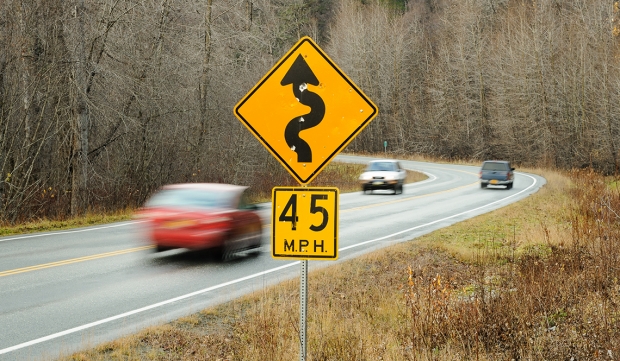
The Alaska Department of Transportation is proposing to widen and realign a 21.8-mile section of the two-lane Haines Highway (AK 7) near Haines, Alaska and bring the road up to federal highway standards. The department’s goal is to widen the highway, replace the Chilkat River Bridge, help control landslides and bring the speed limit up from 50 to 55 mph by straightening curves, like this curve at mile 17 of the highway. Much of the rural highway travels through the Alaska Chilkat Bald Eagle preserve.
Some Haines residents worry about the impact the straightening will have on a 15-mile section of the road through the preserve. Bald eagle perching and roosting trees, wetlands and salmon spawning habitat and cultural sites could potentially be affected. The straightening of the curve shown is one of the curves which would require significant work including wetland mitigation and stream relocation.
The Alaska Chilkat Bald Eagle Preserve is the location of one of the largest gatherings of bald eagles in the world each fall. The 48,000 acre area was designated as a preserve in 1982. The Haines Highway is the only road access to Haines. The 152 mile highway travels from Haines, Alaska to Haines Junction, Yukon in Canada where it connects with the Alaska Highway and continental highway system.
