Dengler Images

  • Portfolio
    • Portfolio Book
    • Sample Images
  • Archive
  • Blog
  • Store
    • Licensing
    • Prints
    • Note cards
    • Books
  • About
    • Bio
    • Services
    • Newsletter Signup
    • Instagram
    • Copyright
    • Privacy Policy
  • Contact

Prairie chicken photos published by North American Grouse Partnership

November 26, 2023 by John L. Dengler

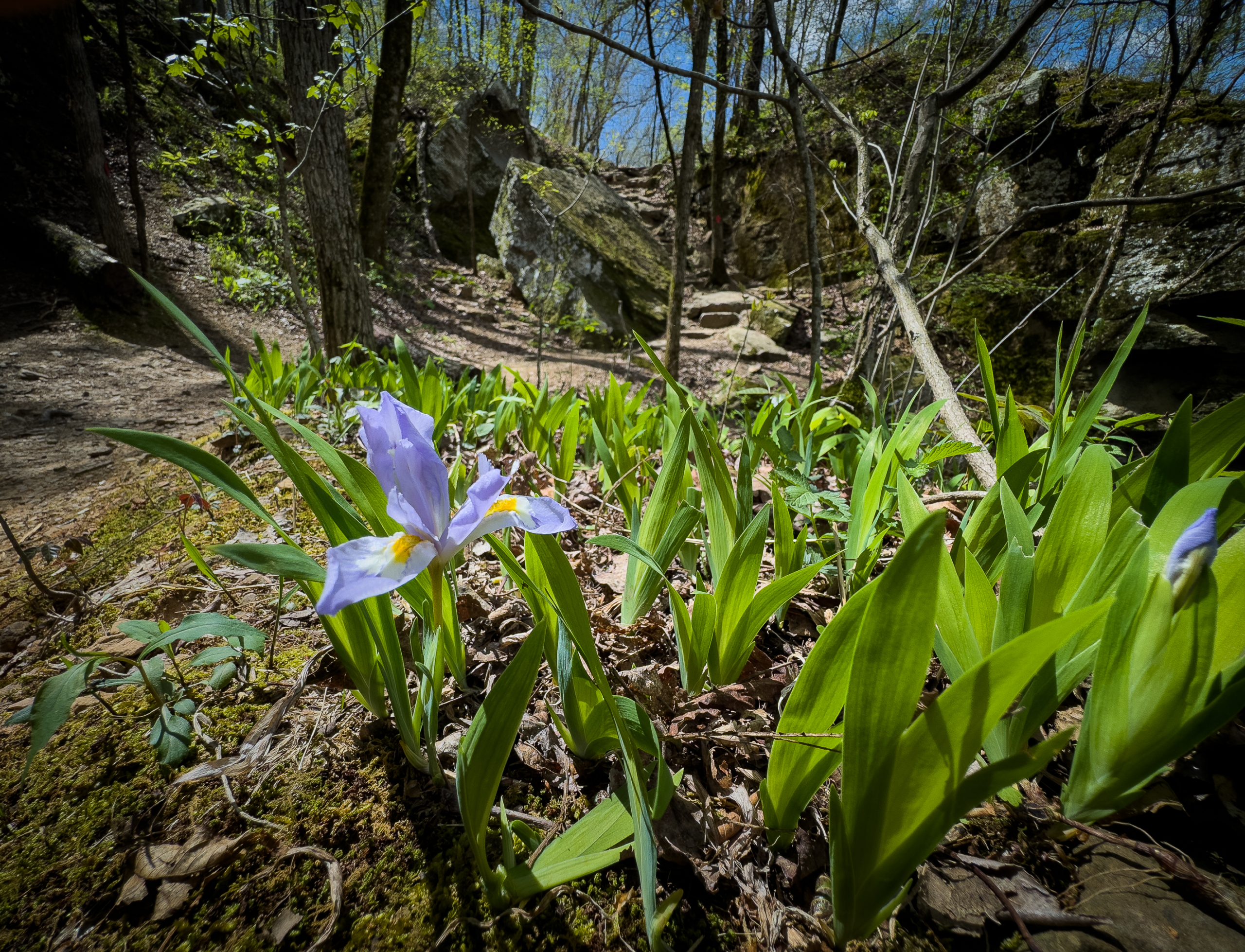
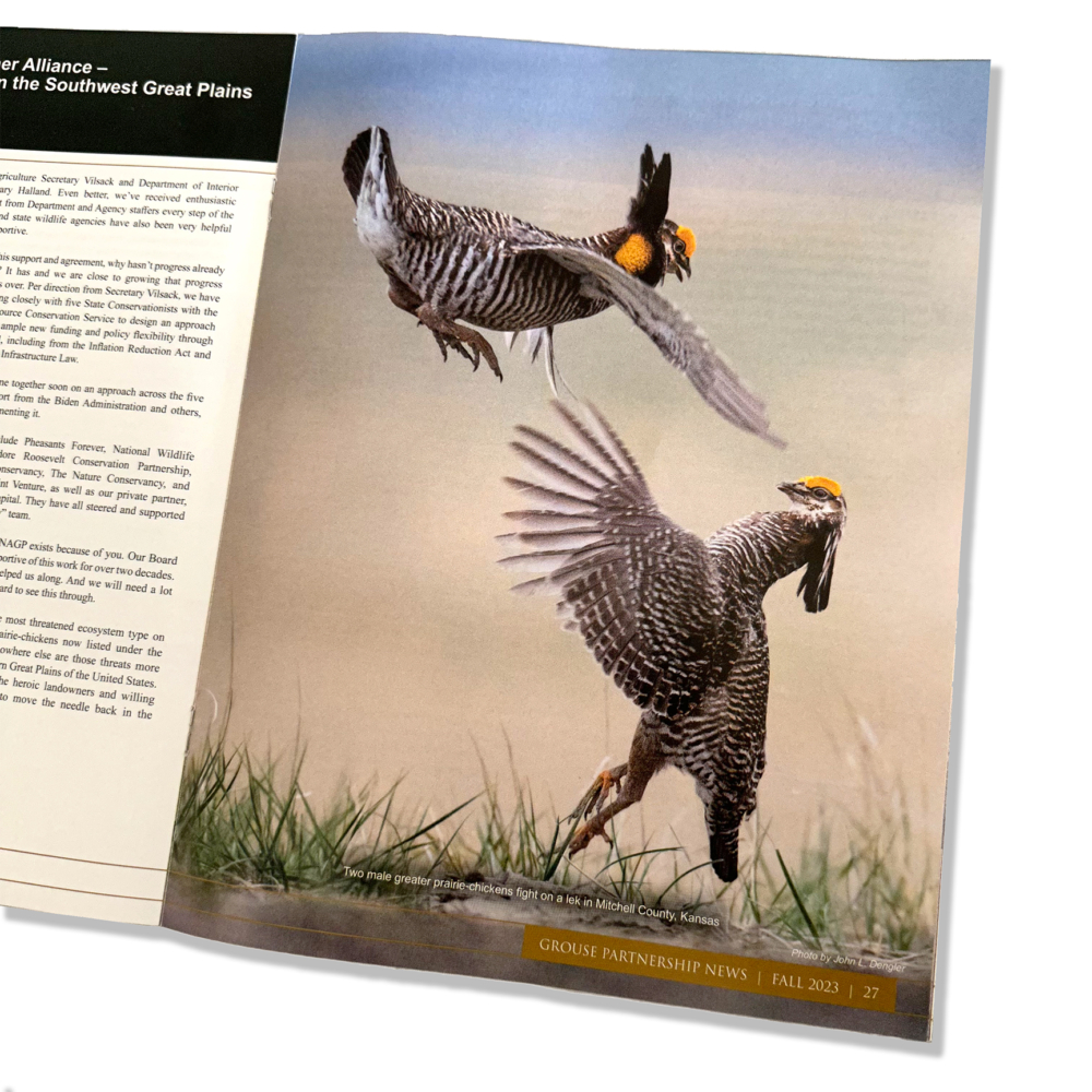
I am very pleased with the display of two of my photos in the Fall 2023 edition of the Grouse Partnership News, the annual magazine of the North American Grouse Partnership. Both images ran full-page size. This picture ran on the inside and another on the back cover.

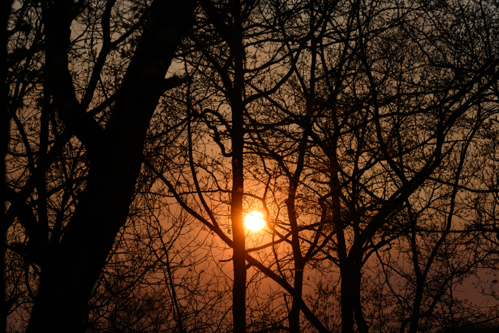
This image of two male greater prairie-chickens fighting was photographed on a lek in Mitchell County, Kansas.

The greater prairie-chicken or pinnated grouse (Tympanuchus cupido) is known for its mating ritual by males called booming. In the spring, males gather on leks, also known as booming grounds, in which they defend small areas on the lek to perform their mating displays for visiting females. This display includes extending their orange eye combs, lowering the head, raising two tufts of feathers on the neck, and pointing the tail slightly forward while stamping their feet rapidly. They also expand their bright orange air sac to produce a booming-like sound that can be heard up to a mile away. In addition, males will vigorously defend their territory on the lek by chasing, leaping in the air, and dramatic fighting. 

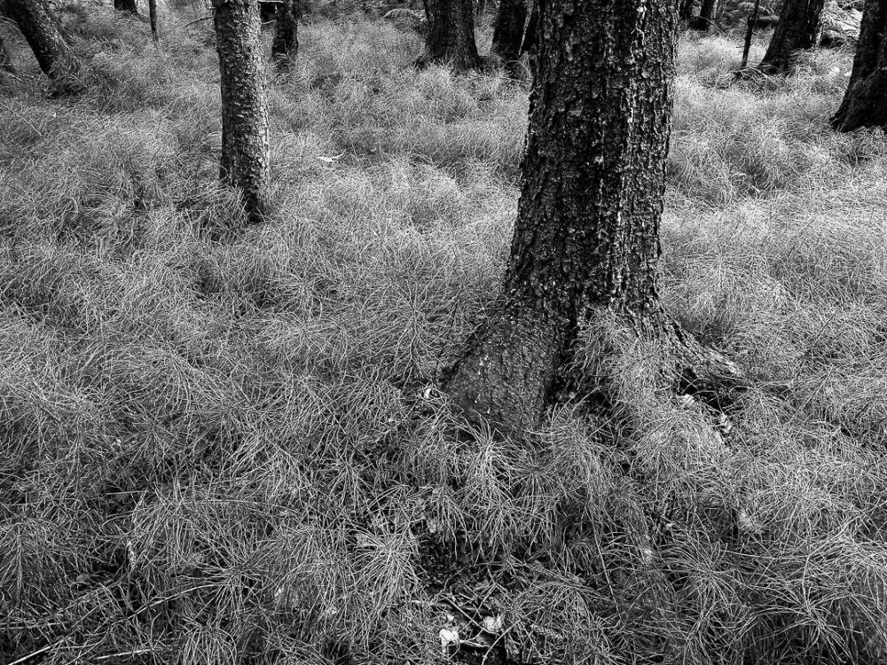
Greater prairie-chickens are threatened by climate changes (drought or too much rain) and habitat loss. In particular, habitat loss caused by wind energy development. Prairie-chickens need large expanses of open grassland without tall objects (like wind turbines or power lines and power poles) that provide a raptor to perch on.

The mission of The North American Grouse Partnership is to promote the conservation of grouse and the habitats necessary for their survival and reproduction. It is the only conservation organization that advocates for all 12 North American grouse species and their habitats. Their goal is to ensure that grouse conservation is guided by science, public policies are beneficial to grouse and that on-the-ground management of lands lead to positive outcomes for grouse.

LINKS:

  • PHOTO GALLERY: Greater Prairie-Chicken
  • BLOG: A wild grouse chase — the search for greater and lesser prairie-chickens

Springtime at Devil’s Den

April 23, 2023 by John L. Dengler

An eastern redbud tree (Cercis canadensis) blooms in front of the rock dam that spans Lee Creek forming Lake Devil in Devil’s Den State Park. The 8-acre lake is popular for fishing and boating with canoes and pedal boats for rent.

Our dog Blue had such a great time visiting Devil’s Den State Park in northwest Arkansas last fall that we thought we would visit in the Spring. None of us, including Blue was disappointed. If this is where the Devil hangs out, then perhaps Hell isn’t as bad as people say.

Devil’s Den State Park has approximately 64 miles of trails popular with hikers, mountain bikers, and horseback riders. One popular trail is the Devil’s Den Self-Guided Trail (1.5 miles long) which passes by Devil’s Den Cave (550 feet), Devil’s Den Ice Box, numerous rock crevices, and Twin Falls. Another popular trail is the Yellow Rock Trail (3.1 miles) which leads to expansive views of the Lee Creek Valley.

Without hesitation, Blue pranced into the cabin like it was home and had never been away.

A stone pathway winds around a cabin built by the Civilian Conservation Corps (CCC) in the 1930s.

The CCC was responsible for building Devil’s Den’s roads, cabins, and other infrastructure. These structures, still in use today, include cabins, trails, a dam, and a shelter. The contributions of the CCC to building our state and national parks are often underestimated. I wonder if today, the government would take on such immense projects in the relatively short time they were completed.

Exploring Devil’s Den Trail

First up was hiking Devil’s Den Trail. The easy trail offers a lot to see, including the rock outcroppings of the Devil’s Den Theater (above) that are fun to explore.

Later, the trail passes by Devil’s Den Cave, Devil’s Ice Box, crevices, and wet-weather waterfalls. The park contains one of the largest sandstone crevice areas in the U.S.

Twin Falls (below) is one of the highlights of the trail. It is a wet-weather waterfall. Unfortunately, there had been very little rain the previous week, so there wasn’t much water cascading. Still, there was enough for me to capture a nice photo of the lower section of the falls next to a redbud and for Carol to capture some video of the upper falls.

A redbud tree (Cercis canadensis) blooms next to Twin Falls along the Devil’s Den Trail in Devil’s Den State Park.

While the trail is short at 1.5 miles long, we took our time exploring the details of the surroundings. Some might have found it painfully slow, but we enjoyed taking our time exploring off-trail and taking photos.

While I opted to play Ansel Adams with black-and-white photos,

Carol went the Technicolor route and captured this nice spring-like photo of a crested iris.

Hammock time

After all that hiking, it was hammock time back at the cabin. Hammock views don’t get better than this view of dogwood blossoms (Cornus Florida) looking up from my hammock. Cool temperatures, warm sunshine, gentle breeze — simply perfect.

While Carol continued to read in her hammock, I eventually got restless and decided to photograph the wildflowers around the cabin.

Our trip timing was perfect for viewing the spring wildflowers. I experimented with putting extension rings on a 400mm telephoto lens for a close-up view of Eastern spring beauty (Claytonia virginica). For reference, the flower is actually about the size of a dime 

Photography is all about light. I took advantage of the dramatic natural lighting of the forest for photos of violet wood sorrel (Oxalis violacea) (above), backlit maple trees (left), Eastern spring beauty (right) or a Dogwood tree (Cornus florida) (left).

I also watched a large bee-fly (Bombylius major) take nectar from dogwood blossoms. The large bee-fly is a non-stinging parasitic bee mimic often mistaken for a bumblebee. This resemblance allows the large bee-fly to get close to the nests of bees and wasps where the large bee-fly will deposit its eggs. When the large bee-fly eggs hatch, the larvae feed on the bee and wasp grubs.

Evening at the cabin

The park is also known for its well-preserved Civilian Conservation Corps (CCC) structures built in the 1930s. These structures, still in use today include cabins, trails, a dam, and a shelter. For “sleep-on-the-dirt” backpackers staying in a cabin with running water is a special treat. For us, it’s like staying at the Ritz-Carlton.

Now that Carol and I are retired, we realize a prime benefit of retirement is being able to travel during the off-season. This state park is typically very busy in the summer and on weekends. Traveling off-season, in the middle of the week, made it feel very peaceful.

Despite all the hiking, particularly hiking with probably close to 24 pounds of camera equipment, I still manage to always gain weight on trips like this. I think you can see why below. Carol always manages to grill up yummy eats

More hiking – the Yellow Rock Trail

The following day, we hiked up the bluffs of the Yellow Rock Trail. Yellow Rock Trail is a three-mile loop that leads to Yellow Rock, a bluff that offers an expansive view of Lee Creek and its valley. The trail is one of the original CCC-constructed trails. There are two trailheads. One near Camping Area A and another from the Highway 170 Overlook. The overlook trailhead makes for an easier hike, but you’ll miss seeing the bluff overhangs/rock shelters like below.

Yellow Rock, seen from the Yellow Rock Trail in Devil’s Den State Park. The Yellow Rock Trail leads to this scenic overlook of the Lee Creek Valley. The Yellow Rock Trail is a CCC-constructed trail from the 1930s. It is also a designated part of the National Trails System. The main feature is the Yellow Rock, offering a scenic view of the Lee Creek Valley.

A black vulture (Coragyps atratus) rests on a boulder along the Yellow Rock Trail in Devil’s Den State Park. Unlike the red-headed turkey vultures, the sense of smell of a black vulture is not as good as the red-headed turkey vulture. Because of this, black vultures will often follow turkey vultures to carcasses to feed.

The bluff at Yellow Rock provides a scenic view of Lee Creek and the Lee Creek Valley in Devil’s Den State Park. The Yellow Rock Trail leading to the is a CCC-constructed trail from the 1930s. It is also a designated part of the National Trails System.

Mr. DeMille, I’m Ready for My Close Up

Since I know, in reality, all that anyone is going to care about are photos of Blue, here are a few extras from hanging around the cabin. Blue is ready to return.

LINKS

  • BLOG POST – In her own words, Blue describes her first trip to Devil’s Den
  • PHOTO GALLERY of additional images of Devil’s Den State Park

Sharp-tailed grouse video published by Audubon Magazine

April 1, 2023 by John L. Dengler

I’m pleased that the online version of Audubon Magazine used my video of Columbian sharp-tailed grouse to accompany the still photographs by my friend Noppadol Paothong. Over the years, I have accompanied Nop on several trips to this lek. His photos and my video were from our most recent visit last spring. The link to my video is about ¾ down into the story. As the story says, traveling to the lek is via snowshoe in the dark, and the conditions are typically windy and very cold. That’s just the beginning, though. Shooting video of sharp-tailed grouse is an even greater challenge. Even with state-of-the-art cameras, shooting video of sharp-tailed grouse is difficult due to their incredibly fast and erratic movements. However, witnessing the highly animated dancing courtship displays to impress females to mate is worth the effort. 

While it is a fun challenge, it is, more importantly, a subject whose story needs telling. First described by the Lewis & Clark expedition, Columbian sharp-tailed grouse were once the most abundant grouse in the West. Today, Columbian sharp-tailed grouse occupy less than 10 percent of its historic range. It is currently considered a Species of Concern in several U.S. states.

LINK TO AUDUBON MAGAZINE STORY WITH THE VIDEO: https://www.audubon.org/magazine/spring-2023/a-dancers-stage

Black and White – only because I felt like it

January 30, 2023 by John L. Dengler

You know how you yearn for chili or soup on the cold, blustery, gray days in winter? Well, I guess the same can be said about how a dark gray day like today affected my approach to today’s editing of images.

There’s no real story to the following photos, just some miscellaneous photos from a recent trip to Haines, Alaska, last August that I thought I would process in black and white. No highfaluting artist statements on the reason behind the conversion to black and white. It’s just because I felt like it. It is as simple as that.

Chilkoot Indian Association Trail -Haines

The Chilkoot Indian Association (CIA)Trail in Haines is a relatively new, in-town trail near the Southeast Alaska State Fairgrounds. While walking on the peaceful, easy-to-travel path, you feel like you are in the middle of nowhere when in reality, you are only a few blocks from homes and the Haines public school. If you are lucky, you might see a bear or moose that has retreated to the forest after sneaking into town. The trail is a very nice addition to Haines. Depending on where you are staying in Haines, it makes a nice stroll to and from the Saturday Farmer’s Market at the fairgrounds.

Common horsetail (Equisetum arvense) along the Chilkoot Indian Association Trail in Haines, Alaska. Common horsetail is a fern. Moose, caribou, sheep, and bears eat this plant.

Detail of grass in a wetland stream along the Chilkoot Indian Association Trail in Haines, Alaska.

The spectacular scenery of the Lynn Canal

The views from the Alaska state ferry on the four-plus hour trip from Juneau to Haines are spectacular. I’m always befudled to see people sleeping on the ferry when spectacular views like the below are for the taking (in addition to whales and other marine wildlife). I’m equally befuddled seeing the cruise ships travel this route during the dinner hour and late into the evening only so the passengers can get to the next port in the morning. I’d rather see views like the ones below than have extra time at a jewelry shop in port.

The Lynn Canal is not a man-made canal but rather a glacier-formed fjord. It is one of the deepest and longest fjords in the world. It is about 90 miles long, traveling from the Juneau area to Skagway over 2,000 feet deep. As a major shipping and transportation route, the fjord connects highway-isolated Juneau with Haines and Skagway. It was also a major water route during the Klondike Gold Rush.

Unnamed peaks (left) in the Tongass National Forest rise above Yeldagalga Creek next to the edge of Sinclair Mountain (right) as seen from the Lynn Canal near Haines, Alaska.

Davidson Glacier is framed by Talsani Island and the tip of the Chilkat Peninsula, in this view from the Lynn Canal near Haines, Alaska.

Davidson Glacier is framed by Talsani Island and the tip of the Chilkat Peninsula in this view from the Lynn Canal near Haines, Alaska.

There you have it. No color. Just black and white. Now time for some warm spicy soup.

LINKS

  • BLOG: Alaska travel tips
  • PHOTO GALLERY: Haines, Alaska
  • PHOTO GALLERY: Juneau, Alaska

« Previous Page
Next Page »

Search this blog

Follow Me

  • Email
  • Facebook
  • Instagram
  • RSS
  • Vimeo

Recent Dispatches

  • Recent landslide-triggered tsunami brings back memories
  • Nature’s Window: Snowy, quiet day in Haines
  • Channeling Bradford Washburn
  • Haines Winterfest equals winter fun
  • Prairie chicken photos published by North American Grouse Partnership
  • Springtime at Devil’s Den
  • Sharp-tailed grouse video published by Audubon Magazine
  • Black and White – only because I felt like it

Blog Category Topics

  • Books
  • Environment
  • Fauna
  • Featured
  • Fine art prints
  • Flora
  • Gear
  • iPhone Field Reports
  • Landscapes
  • Latest Dispatches
  • Note cards
  • Passions
  • Personal
  • Photojournalism
  • Recreation
  • Research
  • Sports
  • Tearsheets
  • Techniques
  • Travel
  • Videos
  • Wildlife

New archive images

Gallery of new outdoor photos added to photo archive

Contact

Phone:
+1.417.849.5642
Email:
[email protected]

Copyright Information

All photographs and text within DenglerImages.com are copyright John L. Dengler and/or the stated publication and are presented for web browser viewing only. Nothing contained within this site may be reproduced, downloaded, stored, copied, manipulated, altered, or used in any form without prior written permission from John L. Dengler and/or the stated publication. Do not "pin" images on pinning sites (Pinterest, Tumblr, etc.). Using any image as the base for another illustration or graphic content, including photography, is a violation of copyright and intellectual property laws. Violation of copyright will be actively prosecuted.

Newsletter signup

Sign up for our free email newsletter to keep updated on recent work, new products, or coupon specials. Simply enter your details, and confirm your address with the confirmation email that we send. It's easy and safe. We never share our newsletter list.

CLICK HERE to sign-up to receive newsletter and new blog post alerts.

Dengler Images, LLC specializes in stock image licensing of photos of wildlife, nature, landscape,
outdoor sports and recreation, travel, and our environment.

© 2008-2025 John L. Dengler, Dengler Images, LLC - All rights reserved.